Vietnamese provinces database
A complete SQL dataset of Vietnamese administrative units, includes Vietnamese provinces, districts and wards
A complete SQL (and also non-SQL) databases of Vietnamese administrative units, includes all **34 Vietnamese provinces** and associated districts, wards sub-divisions. Data is updated as of the most recent effective decree: [30/2026/QH16][source government decree] **Add-on includes**: SQL GIS Dataset The project is written primarily in PLpgSQL, distributed under the MIT License license, first published in 2021. It has gained significant community traction with 1,195 stars and 297 forks on GitHub. Key topics include: database, dataset, districts, locality, provinces.

![]()
Vietnamese Provinces Database
A complete SQL (and also non-SQL) databases of Vietnamese administrative units, includes all 34 Vietnamese provinces and associated districts, wards sub-divisions.
Data is updated as of the most recent effective decree: 30/2026/QH16
Add-on includes: SQL GIS Dataset
If you find this repository helpful, please consider giving it a ⭐ — it helps us stay motivated to keep improving and delivering valuable tools for the community. Also, starring the repo makes it easier to stay updated with future releases.
Overview
The author(s) of this repository is not associated with the General Statistics Office of Vietnam, nor the Vietnamese government.
The data of provinces and wards are created base on the API province data provided by the General Statistics Office of Vietnam website.
This dataset also include additional information apart from the original provinces, wards data from the original data. Please see section Additional change make by this repository.
Dataset releases and Government issued decrees
The Vietnamese Government may issue decree from time to time to adjust the administrative unit structure. You can track the latest issued decrees here.
The following table contains a list of issued decrees and their effective dates, tracked from the earliest version of this dataset.
| Issued Decree/Description | Issued on | Effect from | Release Version |
|---|---|---|---|
| Add GIS dataset | --- | --- | v4.0.0 |
| 30/2026/QH16, 237/NQ-UBTVQH16 | 14/04/2026 | 30/04/2026 | v3.1.0 |
| 19/2025/QĐ-TTg | 30/06/2025 | 01/07/2025 | v3.0.2 |
| Grammar-correction, data cutoff before 19/2025/QĐ-TTg | 15/01/2025 | 01/03/2025 | v2.4.1 |
| 1365/NQ-UBTVQH15 | 15/01/2025 | 01/03/2025 | v2.4.0 |
| 1318/NQ-UBTVQH15 | 30/11/2024 | 01/01/2025 | v2.3.0 |
| 1203/NQ-UBTVQH15 | 28/09/2024 | 01/11/2024 | v2.2.0 |
| 1106/NQ-UBTVQH15 | 23/07/2024 | 01/09/2024 | v2.1.0 |
| 1013/NQ-UBTVQH15 | 19/03/2024 | 01/05/2024 | v2.0.1 |
| 939/NQ-UBTVQH15 | 13/12/2023 | 01/02/2024 | v2.0.0 |
| From 721/NQ-UBTVQH15 to<br>730/NQ-UBTVQH15 | 13/02/2023 | 10/04/2023 | v1.0.4.1 |
| 569/NQ-UBTVQH15,<br>570/NQ-UBTVQH15 | 11/08/2022 | 01/10/2022 | v1.0.3.1 |
| 510/NQ-UBTVQH15 | 12/05/2022 | 01/07/2022 | v1.0.2 |
| 469/NQ-UBTVQH15 | 15/02/2022 | 10/04/2022 | v1.0.1 |
| 387/NQ-UBTVQH15 | 22/09/2021 | 01/11/2021 | v1.0.0 |
Additional Changes Made by This Repository
- Added
administrative_regionstable - Added
administrative_unitstable - Assigned administrative units to province and ward data
- Generated English names for provinces and wards, offering both full and short forms
- Generated code names (slugs) for provinces and wards
- Add-on: Additional GIS dataset for administrative units
Installation
Create a database (if applicable):
sqlCREATE DATABASE vietnamese_administrative_units;
Then execute the following scripts in order:
CreateTable_vn_units.sql– creates the database schema.ImportData_vn_units.sql– imports the dataset.
Choose the scripts from the corresponding database directory:
| Database | Directory |
|---|---|
| PostgreSQL | postgresql/ |
| MySQL / MariaDB | mysql/ |
| Microsoft SQL Server | sqlserver/ |
| Oracle | oracle/ |
Oracle users may use an existing database/schema, as database creation is environment-specific.
Tables Schema

administrative_regions table

The administrative_regions table contains the list of 8 Vietnamese geographical regions with the id increment following the region location from North to South.
Table definition
| Column | Data type | Meaning | Constraint |
|---|---|---|---|
id | integer | Id of the region | Primary Key |
name | varchar(255) | Region name in Vietnamese | |
name_en | varchar(255) | Region name in English | |
code_name | varchar(255) | Code name, derived from Vietnamese name, written in lowercase, underscored | |
code_name_en | varchar(255) | Code name, derived from English name, written in lowercase, underscored |
Data preview
| id | name | name_en | code_name | code_name_en |
|---|---|---|---|---|
| 1 | Đông Bắc Bộ | Northeast | dong_bac_bo | northest |
| 2 | Tây Bắc Bộ | Northwest | tay_bac_bo | northwest |
| 3 | Đồng bằng sông Hồng | Red River Delta | dong_bang_song_hong | red_river_delta |
| 4 | Bắc Trung Bộ | North Central Coast | bac_trung_bo | north_central_coast |
| 5 | Duyên hải Nam Trung Bộ | South Central Coast | duyen_hai_nam_trung_bo | south_central_coast |
| 6 | Tây Nguyên | Central Highlands | tay_nguyen | central_highlands |
| 7 | Đông Nam Bộ | Southeast | dong_nam_bo | southeast |
| 8 | Đồng bằng sông Cửu Long | Mekong River Delta | dong_bang_song_cuu_long | southwest |
administrative_units table

The administrative_units table contains a list of administrative units with id sorted by two tier levels.
Table definition
| Column | Data type | Meaning | Constraint |
|---|---|---|---|
id | integer | Id of the administrative unit | Primary Key |
full_name | varchar(255) | Full name of the administrative unit in Vietnamese | |
full_name_en | varchar(255) | Full name of the administrative unit in English | |
short_name | varchar(255) | Short name of the administrative unit in Vietnamese | |
short_name_en | varchar(255) | Short name of the administrative unit in English | |
code_name | varchar(255) | Code name, derived from Vietnamese full_name, written in lowercase, underscored | |
code_name_en | varchar(255) | Code name, derived from English full_name_en, written in lowercase, underscored |
Data preview
| id | full_name | full_name_en | short_name | short_name_en | code_name | code_name_en |
|---|---|---|---|---|---|---|
| 1 | Thành phố trực thuộc trung ương | Municipality | Thành phố | City | thanh_pho_truc_thuoc_trung_uong | municipality |
| 2 | Tỉnh | Province | Tỉnh | Province | tinh | province |
| 3 | Phường | Ward | Phường | Ward | phuong | ward |
| 4 | Xã | Commune | Xã | Commune | xa | commune |
| 5 | Đặc khu tại hải đảo | Special administrative region | Đặc khu | Special administrative region | dac_khu | special_administrative_region |
provinces table

The provinces table contains a list of first administrative tier - the provincial level units, includes 34 municipalities and provinces.
Table definition
| Column | Data type | Meaning | Constraint |
|---|---|---|---|
code | varchar(20) | The official unit code, defined by government | Primary Key |
name | varchar(255) | Name in Vietnamese | |
name_en | varchar(255) | Name of in English | |
full_name | varchar(255) | Full name in Vietnamese, includes the administrative unit name | |
full_name_en | varchar(255) | Full name in English, includes the administrative unit name | |
code_name | varchar(255) | Code name, derived from name, written in lowercase, underscored | |
administrative_unit_id | integer | The administrative unit id of this record | Foreign Key, references to administrative_units.id |
Data preview
| code | name | name_en | full_name | full_name_en | code_name | administrative_unit_id |
|---|---|---|---|---|---|---|
| 01 | Hà Nội | Ha Noi | Thành phố Hà Nội | Ha Noi City | ha_noi | 1 |
| 56 | Khánh Hòa | Khanh Hoa | Tỉnh Khánh Hòa | Khanh Hoa Province | khanh_hoa | 2 |
| 79 | Hồ Chí Minh | Ho Chi Minh | Thành phố Hồ Chí Minh | Ho Chi Minh City | ho_chi_minh | 1 |
| 96 | Cà Mau | Ca Mau | Tỉnh Cà Mau | Ca Mau Province | ca_mau | 2 |
| .. | ........... | ........... | ..................... | ................ | ........... | .. |
wards table

The wards table contains a list of second administrative tier - the commune level units, includes 3321 wards, communes and special administrative region.
Table definition
| Column | Data type | Meaning | Constraint |
|---|---|---|---|
code | varchar(20) | The official unit code, defined by government | Primary Key |
name | varchar(255) | Name in Vietnamese | |
name_en | varchar(255) | Name of in English | |
full_name | varchar(255) | Full name in Vietnamese, includes the administrative unit name | |
full_name_en | varchar(255) | Full name in English, includes the administrative unit name | |
code_name | varchar(255) | Code name, derived from name, written in lowercase, underscored | |
province_code | varchar(20) | The province this record belongs to | Foreign Key, references to provinces.code |
administrative_unit_id | integer | The administrative unit id of this record | Foreign Key, references to administrative_units.id |
Data preview
| code | name | name_en | full_name | full_name_en | code_name | province_code | administrative_unit_id |
|---|---|---|---|---|---|---|---|
| 25920 | Tân Hiệp | Tan Hiep | Phường Tân Hiệp | Tan Hiep Ward | tan_hiep | 79 | 3 |
| 25942 | Dĩ An | Di An | Phường Dĩ An | Di An Ward | di_an | 79 | 3 |
| 25945 | Tân Đông Hiệp | Tan Dong Hiep | Phường Tân Đông Hiệp | Tan Dong Hiep Ward | tan_dong_hiep | 79 | 3 |
| 25951 | Đông Hòa | Dong Hoa | Phường Đông Hòa | Dong Hoa Ward | dong_hoa | 79 | 3 |
| 25966 | Lái Thiêu | Lai Thieu | Phường Lái Thiêu | Lai Thieu Ward | lai_thieu | 79 | 3 |
| 25969 | Thuận Giao | Thuan Giao | Phường Thuận Giao | Thuan Giao Ward | thuan_giao | 79 | 3 |
| 25975 | An Phú | An Phu | Phường An Phú | An Phu Ward | an_phu | 79 | 3 |
Sample Queries
You can easily create query to get all the kind of data you need since the tables are clearly referenced between each others.
Here is some sample queries to start with:
Get all wards under a province
Get all wards under Khánh Hoà province
sqlSELECT w.code, w."name" , w.full_name , w.full_name_en ,au.full_name as administrative_unit_name FROM wards w INNER JOIN administrative_units au ON w.administrative_unit_id = au.id WHERE w.province_code = '56' -- Khanh Hoa province code ORDER BY w.code;
| code | name | full_name | full_name_en | administrative_unit_name |
|---|---|---|---|---|
| 22333 | Bắc Nha Trang | Phường Bắc Nha Trang | Bac Nha Trang Ward | Phường |
| 22366 | Nha Trang | Phường Nha Trang | Nha Trang Ward | Phường |
| 22390 | Tây Nha Trang | Phường Tây Nha Trang | Tay Nha Trang Ward | Phường |
| 22402 | Nam Nha Trang | Phường Nam Nha Trang | Nam Nha Trang Ward | Phường |
| 22411 | Bắc Cam Ranh | Phường Bắc Cam Ranh | Bac Cam Ranh Ward | Phường |
| 22420 | Cam Ranh | Phường Cam Ranh | Cam Ranh Ward | Phường |
| 22423 | Ba Ngòi | Phường Ba Ngòi | Ba Ngoi Ward | Phường |
| 22432 | Cam Linh | Phường Cam Linh | Cam Linh Ward | Phường |
Non-SQL Formats
Along with traditional SQL dataset, the Vietnamese Provinces Database also comes with non-sql data format, this includes
- JSON format (feature full, simplified and vn_only_simplified versions)
- MongoDB
- Redis
Add-ons
In addition to the administrative units dataset, this repository also includes optional add-on data extend its functionality.
GIS Dataset
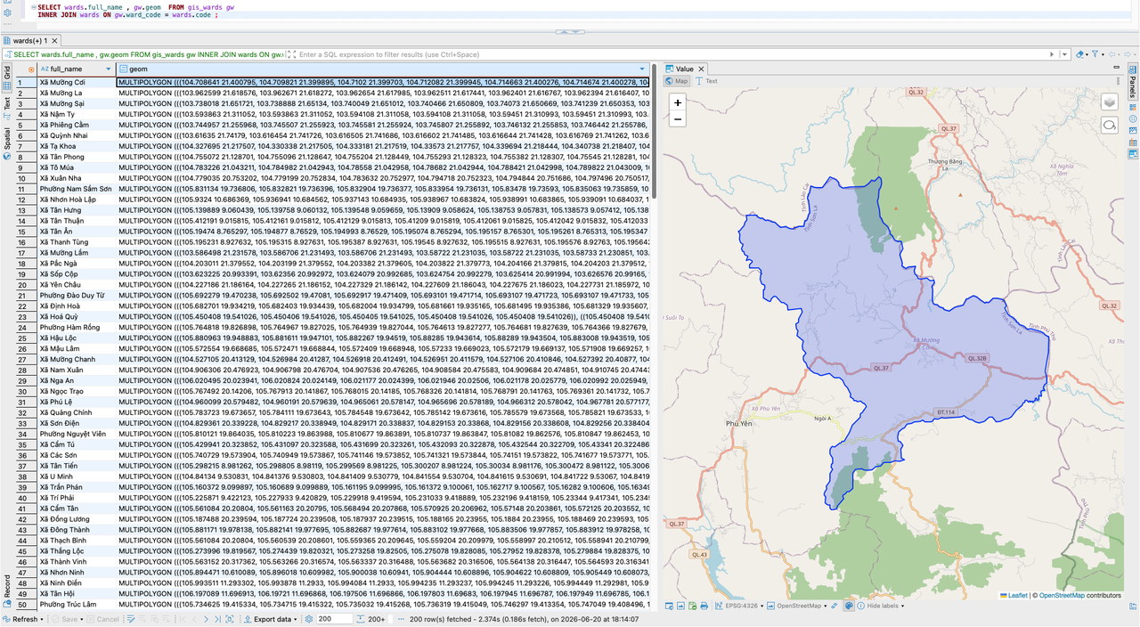
The GIS add-on provides administrative boundary geometries for Vietnamese administrative units and is available for
- PostgreSQL/PostGIS
- MySQL
- Microsoft SQL Server
See GIS Dataset
FAQ
What is the original data source that this repository develope from?
The data of provinces and wards are created base on the API province data provided by the General Statistics Office of Vietnam website.
GIS boundary data was derived from the Vietnam Administrative Units Reference Map, published by the Vietnam Natural Resources, Environment and Cartography Publishing House under the Ministry of Agriculture and Environment.
How are the primary keys defined?
| Table | Primary Key |
|---|---|
administrative_regions | Key: id. Starting from 1 to 8, follow the geographical location order from North to South |
administrative_units | Key: id. Starting from 1 to 5, follow the tier order from biggest unit to smallest unit |
provinces | Key: code. Officially referenced from government unit code |
wards | Key: code. Officially referenced from government unit code |
The province - administrative region relationship is dropped from v3.0.0?
After the provinces merge down to 37 provinces, the new province e.g: Phú Thọ, which is formed from Vĩnh Phúc, Phú Thọ and Hoà Bình that previously span across 3 different regions, so it's no longer applicable to determine which region does the new province belongs to.
Can I use this dataset in commercial projects?
Yes. Absolutely.
This dataset is released under the MIT License, allowing you to use, modify, and distribute it freely in both personal and commercial projects.
No registration, permission request, or licensing fee is required.
If you find the project useful, consider giving it a star ⭐ on GitHub or contributing improvements back to the community.
This repository is an independent community project and is not affiliated with the General Statistics Office of Vietnam or any Vietnamese government agency. The dataset is provided “as is” without warranty of any kind.
I saw some issues in the SQL patch?
If you see any improvement that can be made, please kindly Open a issue and write down your finding. Or even better by Create a Pull Request.
Any contribution is welcomed.
Reference
Vietnam Map in the banner by vietcentertourist
Contributors
<a href="https://github.com/thanglequoc/vietnamese-provinces-database/graphs/contributors"> <img src="https://contrib.rocks/image?repo=thanglequoc/vietnamese-provinces-database" /> </a>It has been a long run to reach for the ⭐
This project has been around since 2022 and is still actively maintained today.
The continued support from the community — shown through stars, issues, and contributions — has been a big motivation to keep improving it. Thank you for helping this project grow!
Contributors
Showing top 4 contributors by commit count.


![dependabot[bot]](https://avatars.githubusercontent.com/in/29110?v=4)

Related Repositories

supabase/supabase
The Postgres development platform. Supabase gives you a dedicated Postgres database to build your web, mobile, and AI applications.

netdata/netdata
The fastest path to AI-powered full stack observability, even for lean teams.

redis/redis
For developers, who are building real-time data-driven applications, Redis is the preferred, fastest, and most feature-rich cache, data structure server, and document and vector query engine.

Asabeneh/30-Days-Of-Python
The 30 Days of Python programming challenge is a step-by-step guide to learn the Python programming language in 30 days. This challenge may take more than 100 days. Follow your own pace. These videos may help too: https://www.youtube.com/channel/UC7PNRuno1rzYPb1xLa4yktw

meilisearch/meilisearch
A lightning-fast search engine API bringing AI-powered hybrid search to your sites and applications.

etcd-io/etcd
Distributed reliable key-value store for the most critical data of a distributed system