Lidar degeneracy datasets
LiDAR degeneracy dataset for LiDAR-radar-inertial fusion methods.
Dataset associated with submission for handling LiDAR-degenerative environments through LiDAR-radar-inertial fusion with factor graphs. The project is distributed under the BSD 3-Clause "New" or "Revised" License license, first published in 2023. Key topics include: imu, inertial-navigation-systems, lidar, lidar-degeneracy, odometry.
LiDAR Degeneracy Datasets
Dataset associated with submission for handling LiDAR-degenerative environments through LiDAR-radar-inertial fusion with factor graphs.
The datasets consist of sensor measurements (IMU, LiDAR, and FMCW radar) of an aerial robot manually flown through environments challenging for LiDAR sensors. These are a biking tunnel (geometric self-similarity) and a university corridor filled with fog (obscurants). In addition CAD extrinsics between the sensors are provided.
Environments
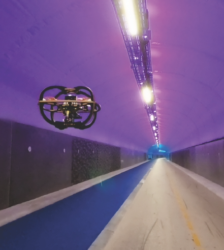
Fyllingsdalen Tunnel
Manual flight along a 8m-wide, 500m-long, straight section of a biking tunnel in Bergen, Norway.
Bag files can be found here
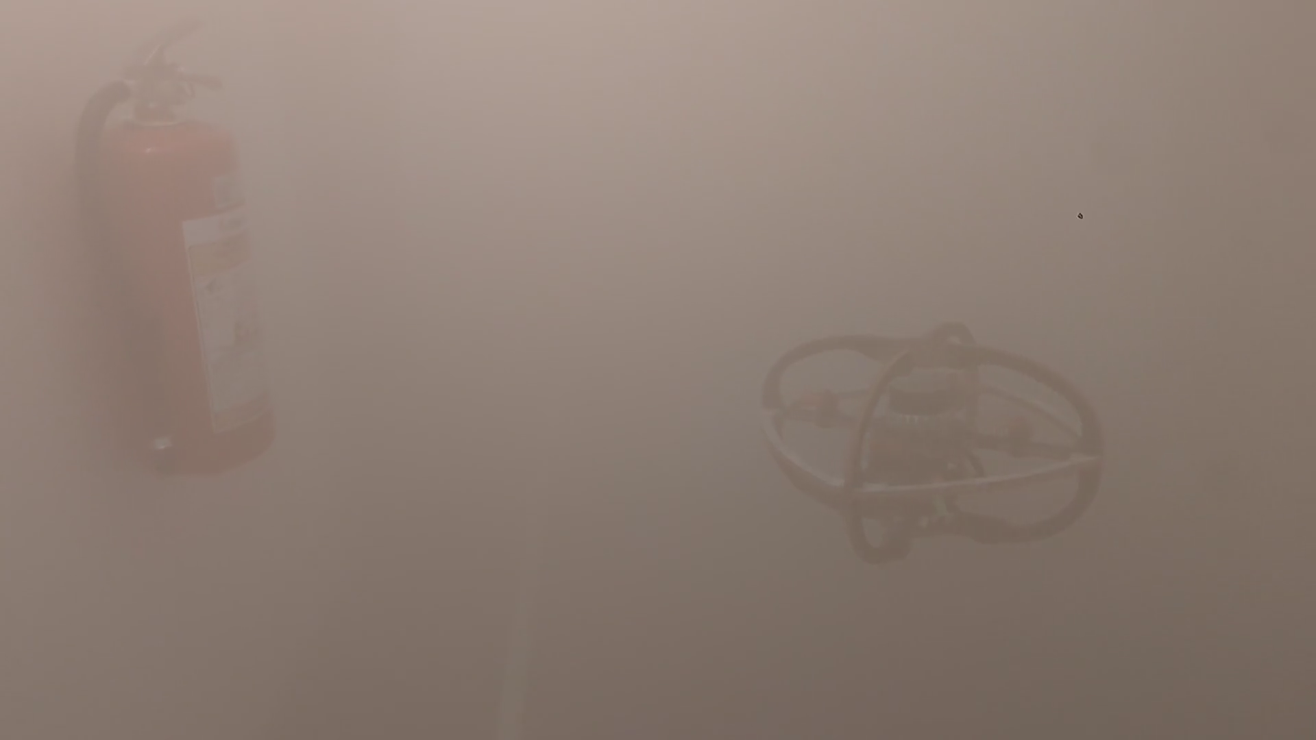
Fog-Filled University Corridor
Manual flight in a university environment in the Elektro building of NTNU in Trondheim, Norway. The first corridor flown through after takeoff is filled with dense fog.
Bag files can be found here
Robot Equipiment
Drone
Sensors
Synchronized using microcontroller-based internally developed synchronization/triggering module
The header time stamp for IMU and radar originate from the triggering module, to replay the trigger-stamped LiDAR data from packet topics use this driver.
Topics
| Source | Topic | Rate [Hz] |
|---|---|---|
| Triggering | - /sensor_sync_node/trigger_0<br>- /sensor_sync_node/trigger_1 | - 800<br>- 10 |
| IMU | /vectornav_node/uncomp_imu | 200 |
| LiDAR | - /os_cloud_node/imu_packets<br>- /os_cloud_node/lidar_packets<br>- /os_cloud_node/metadata | 10 |
| Radar | /radar/cloud | 10 |
Extrinsics
All extrinsics are given with respect to the IMU
LiDAR
- translation [x, y, z]
[-0.00171, 0.02149, 0.0358]
- orientation [x, y, z, w]
[0.000462, 0.0008483, 0.0028835, 0.9999954]
Radar
- translation [x, y, z]
[0.07771, 0.02141, -0.03631]
- orientation [x, y, z, w]
[0.953717, 0, -0.3007058, 0]
Acknowledgements
We thank the Vestland Fylkeskommune for providing access to the Fyllingsdal sykkeltunnel.
Reference
If you use this work in your research, please cite the following publication:
Degradation Resilient LiDAR-Radar-Inertial Odometry (link)
bibtex@inproceedings{nissov2024degradation, author={Nissov, Morten and Khedekar, Nikhil and Alexis, Kostas}, booktitle={2024 IEEE International Conference on Robotics and Automation (ICRA)}, title={Degradation Resilient LiDAR-Radar-Inertial Odometry}, year={2024}, pages={8587-8594}, doi={10.1109/ICRA57147.2024.10611444} }
Contributors
Showing top 2 contributors by commit count.


Related Repositories

ethz-asl/kalibr
The Kalibr visual-inertial calibration toolbox

but0n/Avem
🚁 轻量级无人机飞控-[Drone]-[STM32]-[PID]-[BLDC]

RobustFieldAutonomyLab/LeGO-LOAM
LeGO-LOAM: Lightweight and Ground-Optimized Lidar Odometry and Mapping on Variable Terrain

gaowenliang/imu_utils
A ROS package tool to analyze the IMU performance.

koide3/glim
GLIM: versatile and extensible point cloud-based 3D localization and mapping framework

Aceinna/gnss-ins-sim
Open-source GNSS + inertial navigation, sensor fusion simulator. Motion trajectory generator, sensor models, and navigation